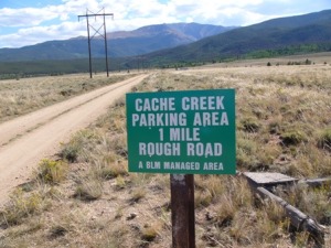
 In an April 2010 article for Colorado Country Life, Gayle Gresham wrote: “My love for maps began the first day of 4th grade at Cherry Valley Elementary School in Douglas County. Mr. O’Quinn, teacher in the “Big Room” (4th – 6th grades), walked to the front of the classroom, pulled a shiny new Colorado map down from its roller and announced a map drill. Before I knew it, I was hearing the names of towns I’d never heard before–Wild Horse, Rifle and Grover–and finding them on the…map.
“Years later, I renewed my love affair with Colorado maps when I started researching my family history. Maps became more personal as I searched for the mining camp of “Cash Creek” [later spelled Cache Creek] where my great-great grandparents first settled in Colorado in 1861…I visited Cash Creek and walked the land where my ancestors had walked; I even panned for gold in Cash Creek!” Gayle says one of the favorite map tools is Google Earth because she can “sit at home and soar over the mountains…zoom in on Cache Creek.”
Have you tried traveling to far away places with computer tools? As Dr. Seuss said, “Oh, the places you will go!”


