Hosting Indians in Washington, 1870s

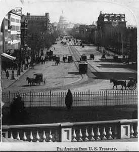
capitolThe many Indian delegations visiting Washington in the 1870s offered great business opportunity for hotel keepers. They often stayed a month or more and the Indian Bureau paid the expenses.

In 1873, the Board of Indian Commissioners audited charges submitted by hotel keepers.  They questioned the large amounts billed by a number of hotels. After an investigation, only one man was charged: Benjamin Beveridge. His mother operated the Washington House hotel at the corner of Third Street and Pennsylvania Avenue. Situated near the railroad station and the Capitol Building, it was a good location for Indian delegations. Benjamin ran a restaurant and saloon on the hotel’s ground floor. He catered to delegations. He obtained theater tickets and arranged a variety of outings to nearby attractions for the visiting Indians.

When the Board of Indian Commissioners examined a batch of bills Mr. Beveridge submitted in 1873, they found problems. That fall three Indian delegations had stayed at the Washington House. Benjamin’s bill for “extras” provided to those delegations totaled $1,338.65. There were tickets for the opera and outings to Mount Vernon by boat. There were also charges for cigars, lemonade, ginger ale, apples, dates, and figs. When the Board looked carefully they found, for example, a bill for 24 tickets to visit Mount Vernon plus meals for the Ute delegation. But there were only fifteen people in the party, including Indian agents and interpreters. The Board found similar problems in numbers of theater and opera tickets on Beveridge’s bill for the Cheyenne and Arapaho delegations. The auditors doubted that the Indians attended the theater and opera twenty-three times in two weeks. Sometimes the theater schedules showed they attended three different performances at the same time.

Information from Diplomats in Buckskins by Herman Viola
Published in: on August 3, 2015 at 6:00 am  Leave a Comment  
Tags: , ,

Kindred Tales from Canada

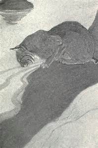
Bull 2Kindred of the Wild: A Book of Animal Life surely delighted children in the early 1900s. Written by Charles G. D. Roberts, the book is enhanced by black and white illustrations by Charles Livingston Bull. The once white pages have mellowed to a soft ocher tone. Some, if not all, of the stories are set in Northern New Brunswick, Canada. There are tales about Indians and people living in the remote wilderness but the lives of animals are the focus.

Sir Charles George Roberts (1860 – 1943) was a Canadian poet and prose writer. His most successful works were animal stories. He drew on his own experience in rural Canada to produce over a dozen animal tales. His poetry brought him recognition as the “Father of Canadian Poetry.”

Charles Livingston Bull (1872-1923) loved to draw from an early age. His father apprenticed him to a taxidermist. At age sixteen he took a job with Ward’s Museum in Rochester, New York. From that experience he landed a job as taxidermist at the National Museum in Washington, D.C.  During his twelve years there he learned the anatomy of a wide variety of animals. To pursue his interest in drawing, he moved to New York City where he found lodging near the Bronx Zoological Gardens. He spent much of his time drawing the animals there and his work sold easily.

Old Books

GeographyOld books are intriguing, not only for their content but for the persons who may have owned them.
          One such book on my shelves is Natural Elementary Geography. It was published by the American Book Company, copyright 1897. My copy appears to be a later printing since it reports 1900 census data. Authors are Jacques W. Redway and Russell Hinman
          The Preface page notes the book is “designed for a pupil’s first text-book in the subject, and is intended for a two-year’s course between the beginning of the third and the end of the fifth school year.” You might expect this to be quite a thick volume to occupy students for two years. The 8”x 10” book has only 144 pages and there are lots of illustrations.
          Another Preface note states, “…one of the most important functions of elementary geography is to teach the names, locations, and characteristics of the countries into which man has divided the earth.”
          While the purpose was to prepare students for more intense study in higher grades, it also offered basic knowledge for “the large proportion of pupils who leave school at an early age.” (Between 1900 and 1919, half of the U.S. student population did not get to eighth grade, according to a 1995 study by Tyack & Cuban.)
          The boy who used this book wrote his name on the fly page: Raleigh Louis Poppe. He apparently had a crush on a girl named Isabella Murphy. He wrote her name beside his own several times in the front of the book.
          The back of the book offers two pages of world population data circa 1900.
          The United States had only 45 states. Arizona, District of Columbia, New Mexico and Oklahoma were territories, along with “Indian Territory.” The total population of the United States was 75,994,575.
          In addition, 91,219 people were listed as “Persons in U.S. service abroad.” (Today over 160,00 active-duty U.S. military personnel are deployed in more than 150 countries around the world.)
          Alaska, Hawaii, Porto (sic) Rico, Philippine Islands, Guam, Wake, and Tutuila, were listed as “Outlying Territories.”

Naming Places, Part 5

left handA number of places in Colorado are named for left-handed people. Boulder County’s Left Hand Creek was named for Andrew Sublette, a lefty fur trader.
          Not far away is the town of Niwot and Niwot Mountain. Both are named for the left handed Chief Niwot of the Arapaho.
          According to Wikipedia, “Peoples of the Andes consider left-handers to possess special spiritual abilities, including magic and healing.” The same source reports that “In tantra Buddhism, the left hand represents wisdom.”
          So, take heart you lefties!

For more information about place names in Colorado, see Colorado Place Names by George R. Eichler (1977) or Colorado Place Names by William Bright (1993).

Published in: on March 30, 2015 at 6:00 am  Leave a Comment  
Tags: , , ,

Naming Places, Part 4

Rico_CourthouseA little spot in Dolores County, Colorado became very popular after silver was discovered there in 1879. Other prospectors rushed to the area hoping to make their own strike.
          A little village formed as more people arrived. They called it Carbon City, then Carbonville, then Lead City, then Dolores City. Finally, the residents held a meeting to pick a new name for their community, one they could all agree on. One man suggested calling it Rico, the Spanish word for “rich.” That was what all the people hoped to become so that became the name of their town.

For more information about place names in Colorado, see Colorado Place Names by George R. Eichler (1977) or Colorado Place Names by William Bright (1993).

Published in: on March 23, 2015 at 6:00 am  Leave a Comment  
Tags: , , , , , ,

Naming Places, Part 3

Canon pintadoCañon Pintado in Rio Blanco County was named by two Spanish speaking priests – Father Domingues and Father Escalante. They passed through the area in 1776 and were struck by the colorful canyon walls decorated with prehistoric Indian pictographs. They named it “painted canyon.”
          Many Spanish names are found in Southern Colorado, which was first settled by Spanish speaking people.
          The town of Nutria in Archuletta County is New Mexican Spanish for “beaver.” In proper Spanish it means “otter.”
          The mountain pass called Raton means “mouse.” In rural New Mexico the term identified a squirrel.
          “Rito” meant a creek in the Spanish language of rural New Mexico and early Southern Colorado. Rito Gato in Conejos County means “cat creek.” Rito Hondo in Hinsdale County means “deep creek.” Rito Oso or “bear creek” is found in Huerfano County.

For more information about place names in Colorado, see Colorado Place Names by George R. Eichler (1977) or Colorado Place Names by William Bright (1993).

Naming Places, Part 2

rabbit The name Conejos means “rabbits” in Spanish. The early settlers, who came from the northern part of Mexico to what is now Southern Colorado, found an abundance of rabbits in the area. They made good eating for the settlers.
          A park in Pueblo County is called Cuerna Verde ark. The name means “green horn.” It was named for a Comanche chief killed there in 1779. 
          Culebra Creek near San Luis is named for the way the creek winds its way across the land like the slithering trail of a snake (culebra in Spanish).
          Curecanti Pass in Gunnison County honors a Tabeguache Ute chief.
          Achonee Mountain in Grand County recalls a Cheyenne named Ochanee or “one eye.” He was killed at Sand Creek in 1864.
          Apiatan Mountain, also in Grand County, is named for a Kiowa Chief known for his singing.

For more information about place names in Colorado, see Colorado Place Names by George R. Eichler (1977) or Colorado Place Names by William Bright (1993).

Published in: on March 9, 2015 at 6:00 am  Leave a Comment  
Tags: , , , , , ,

Naming Places, Part 1

AbarrWhen a few people build homes together in a new place, they soon want to give their community a name. In the days of early Colorado settlement, they also named natural landmarks – mountains and valleys, rivers and creeks.
          Some of those names seem strange to us today. For instance, why anyone would call a town Abarr or Egnar?
          Many early towns were named for Indians, probably those who were friendly.
          Antero Junction in Park County was named for Chief Antero of the Uintah Utes. A mountain and a reservoir also carry his name.
          The town of Ignacio in Southwestern Colorado honors Chief Ignacio of the Weminuche Utes.
          Yarmony was named for a Ute Chief called Yaamani. The name meant “quiet man.”
          Oh, yes, you are still wondering about Abarr and Egnar. Located in Yuma County, Abarr was named for the wife of the town’s founder.
          Apparently, the people of Egnar had trouble deciding on a name. The early settlers came there when range land was opened for homesteading. They took the word “range,” spelled it backward, and that become the town’s name.

For more information about place names in Colorado, see Colorado Place Names by George R. Eichler (1977) or Colorado Place Names by William Bright (1993).

Published in: on March 2, 2015 at 6:00 am  Leave a Comment  
Tags: , , , , ,

Buffalo Hunting

buffalo bones“A species of animal which roamed our plains by the millions became a rare circus and zoological specimen in a period of only twenty years.” So said Percy Stanley Fritz in his 1941 book Colorado The Centennial State.
          Fritz noted the buffalo population began to decline when hunters started using guns instead of the bow and arrow.
          In the early 1870s, gun-toting hunters slaughtered some 4 million buffalo just for their hides. The railroads began to advertise “hunting by rail” excursions. Trains slowed when a massive herd of the huge animals came nearby.  Hundreds of men climbed on top of the rail car and took aim. Some fired from their windows. They left countless 1,500-pound animals dead or dying.
          Over 50,000 hides were shipped east by the Santa Fe Railroad in 1874, according to Fritz. The Kansas Pacific Railroad hauled another 125,000 hides. That same year, the Santa Fe carried 3,400 tons of bleached bones gathered from the plains. These were shipped east for use in button factories or ground up for fertilizer. Some 2 million pounds of buffalo meat was sent east as well.
          Colorado Territory’s Congressman, Hiram Bennet, tried to pass a law to protect the buffalo. His plan was rejected on grounds that it could not be enforced.
          The Texas legislature proposed a law to ban the slaughter of buffalo. General Sheridan opposed it. He said the men shooting buffalo for sport “have done more in the last two years, and will do more in the next year, to settle the vexed Indian question, than the entire regular army has done in the last forty years.”
          By the end of the 19th century, only 300 buffalo were reported to remain in the wild. Congress finally took action. They outlawed killing of any birds or animals in Yellowstone National Park, where the only surviving buffalo herd lived.
          More wildlife preserves helped the buffalo population to slowly rebound. Today, there are more than 200,000 buffalo in North America.
          Is it a buffalo or a bison?

Source: Where the Buffalo Roamed, by Gilbert King, http://www.smithsonianmag.com/history/where-the-buffalo-no-longer-roamed-3067904/?no-ist


Communication Helps

Fort Duschene 1884In late August, 1881 the Uncompahgre Utes were forcibly moved from Colorado to Utah. They settled on a reservation named for Chief Ouray. It was next to the Uintah Agency.
          Five years later, the Bureau of Indian Affairs decided to combine the two reservations under one Indian Agent. The Bureau decided a military base was needed to keep the peace between the Uintah and the Uncompahgre Utes.
          In late August 1886, General Crook marched a company of troops across the Ouray reservation. Panic spread among the Utes as runners carried the news of an invastion of soldiers.
          No one had bothered to inform the Utes of plans for a military post.
          The troops arrived at their destination to meet a contingent of mounted warriors, painted and armed for battle.
          Fortunately, the Indian Agent arrived just ahead of the troops. He was able to facilitate a peaceful meeting with General Crook.
          Fort Duchesne was built and eventually housed 250 soldiers.

Information from Chipeta: Queen of the Utes. Used with permission.


Published in: on February 2, 2015 at 6:00 am  Leave a Comment  
Tags: , , , ,